Contents
| Home | |
| Club News | |
| Event Calendar | |
| Observation | |
| Astronomy News | |
| Photo Gallery | |
| Astronomy Links | |
| Directions | |
| About Us | |
| Membership Form | |
| Observation Aids | |
| Weather Info | |
| Observation Materials |
|
A publication of The Oakland Astronomy Club - A member society of the This website created by |
|
Observation |
What's Up? Download and Find Out!
Download Dave's Picks for July! In this zip file (which will automatically save to your download folder) you'll find an informative pdf file featuring an assortment of interesting objects--some easier, some challenging--that our club will focus on as we observe throughout the month. Even better, use the included .skylist file to import the targets directly into the SkySafari app! (Thanks so much, Dave!!!) The third file is a complimentary copy of this month's map of the night sky from skymaps.com.
Another good download is our list of worthwhile, FREE resources--available by selecting the Citations page.
Club Observation Locations
For information on the next community-based observing opportunities, check our Event Calendar page.
For directions to our primary club observing location, check our Directions page.
For viewing conditions tonight at Adddison Oaks, check our Weather Info page.
Club Loaner Equipment
To learn about observing equipment available for club members to borrow see our Loaners page.
Other Sights to See
|
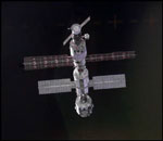
Here is a link that will allow you to type in your city (in the U.S.) and get pass prediction information for the International Space Station (ISS). Note that this information is location-specific, so your timing for viewing the ISS may vary! NOTES: Included are only major cities currently in the range of visibility, with maximum spacecraft elevations over the horizon larger than 10 degrees. The data are also valid for suburban regions around these cities, with slight changes in Direction of Movement and Max. Elevation. Pickup Time: The local time of day that the spacecraft becomes visible on the horizon. Direction of Movement: The spacecraft will appear in the first direction and travel across the sky, rising to the "Maximum Elevation" and disappearing at the horizon in the second direction shown. These compass directions are understood to embrace an angular field of 22.5 degrees each, with their symbols defined as follows: N: North NW: Northwest NNW: North-Northwest SSE: South-Southeast E: East SW: Southwest WNW: West-Northwest ESE: East-Southeast S: South NE: Northeast WSW: West-Southwest ENE: East-Northeast W: West SE: Southeast SSW: South-Southwest NNE: North-Northeast Heaven's Above is a site that provides you with all the information you need to observe satellites such as the International Space Station and the Space Shuttle, spectacular events such as the dazzlingly bright flares from Iridium satellites, as well as a wealth of other spaceflight and astronomical information. Not only does the site provide the times of visibility, but also detailed star charts showing the satellite's track through the heavens. All pages, including the graphics, are generated in real-time and customized for your location and time zone. |
|
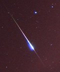
The Authoritative Guide to Visual Meteor Showers is published by the International Meteor Organization (IMO). More information about meteor showers is available from the American Meteor Society.
|


